HAR210715, Flight on July 15, 2021
Launch Location: Duchesne Airport, U69, 40.19667°N, 110.38361°W, 5820 ft ASL
Landing Location: In the middle of an oil field,
40.1110°N, 109.9772°W, 5103 ft ASL
Flight Overview and Schedule (pdf)
Flight Masses, and Fill (pdf)
Flight Trailer Loading Check List (pdf)
Flight Manifest and Flight Data (pdf)
FAA Flight Briefing (pdf)
NOTAM Analysis and Flight Predictions (pdf)
Excel Analysis of the APRS data.
This zip file contains the ozone, iButton (temperature), and Hess radiation data. The ozonesonde stopped working at 7.5 km above sea level because of connection problems with the radiosonde.
MSA (unit D) Excel data
analysis. The GPS stopped working above 12 km then started working again
when it got back down to 12 km above sea level.
Misc. Notes:
Raw data:
APRS packets KD7 and KE7, KMZ files for Google Earth for KD7 and KE7.
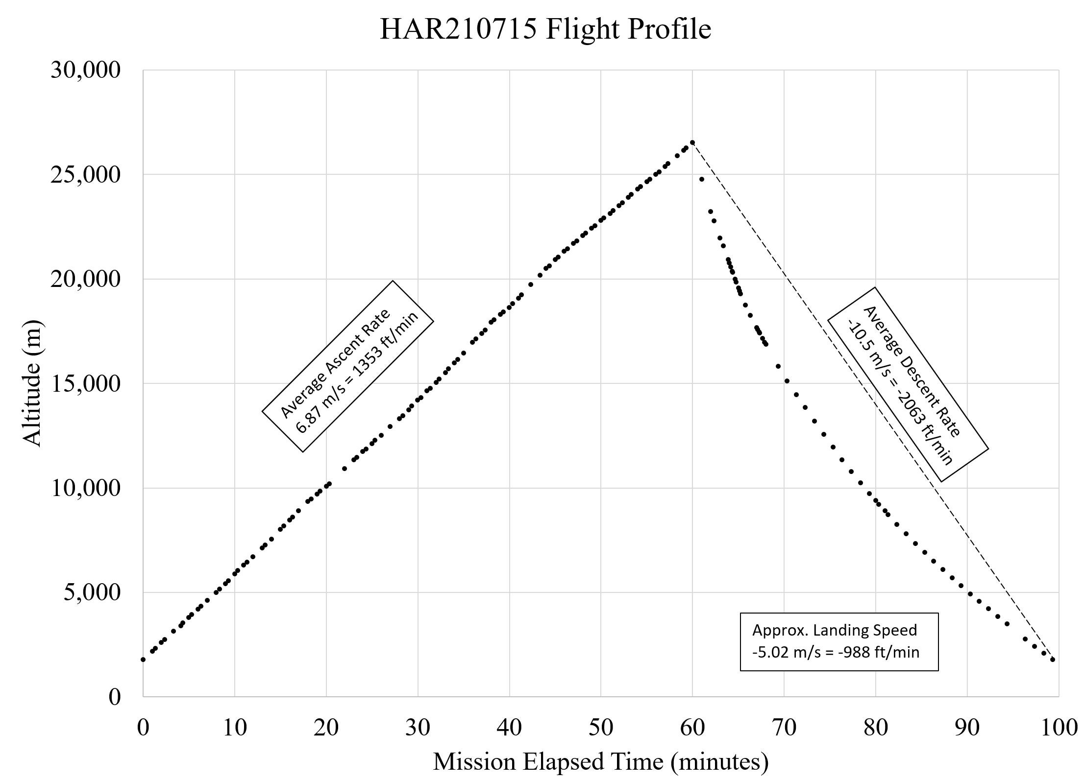
Flight Profile (click for a larger image):
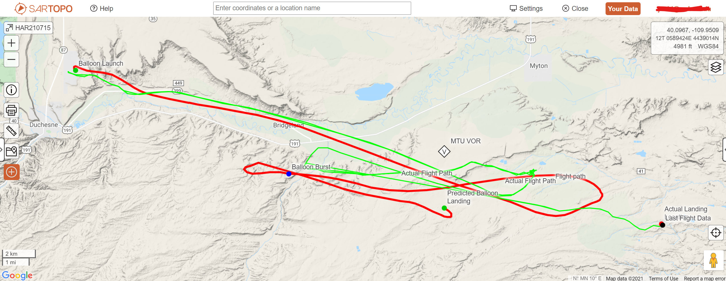
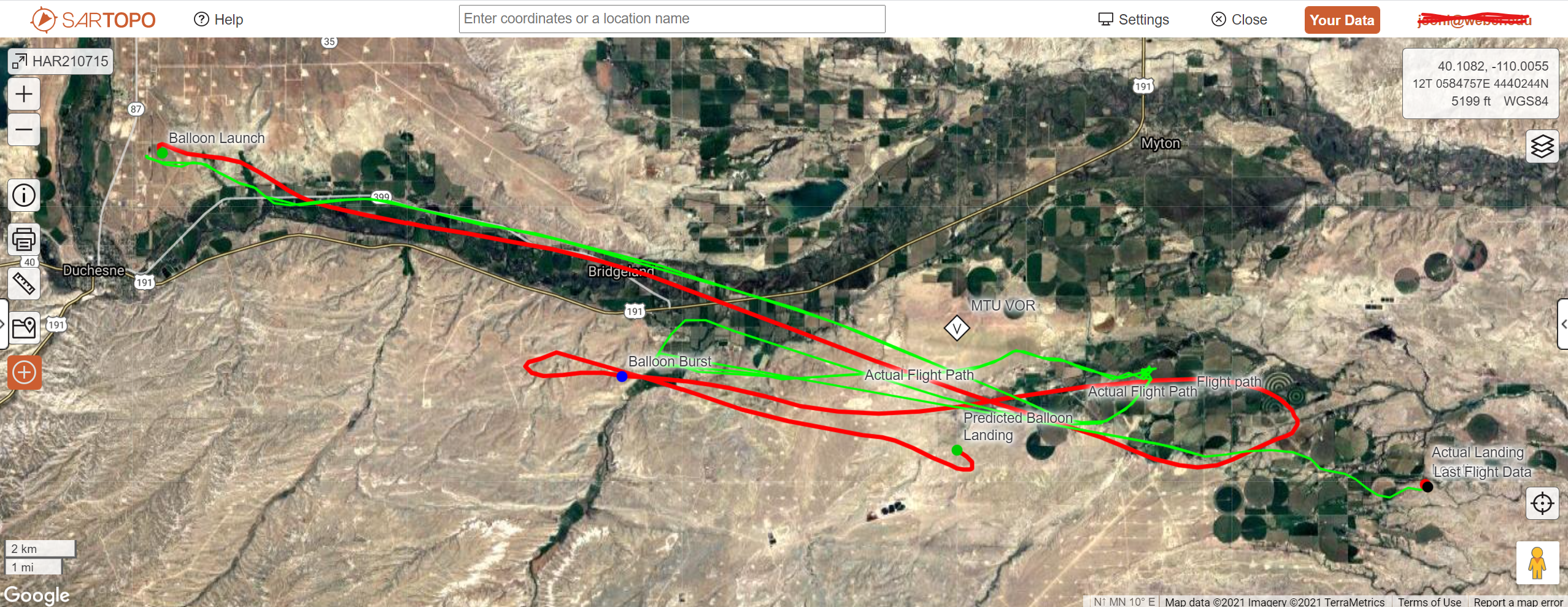
Flight Profile and Prediction (click for a larger image). The red path is the prediction from two days before using the CUSF predictor and the green path is the actual flight path based on the two APRS radio trackers: