Flight Records for HAR210701
Left Ogden at approximately 11:30 a.m. Tuesday in three vehicles, approximately 10
team members.
Arrived at launch location at 4:30 p.m., MDT
Returned Home (Ogden) Wednesday 8:30 pm and completed cleaning the gear and trailer at
approximately 11:30 p.m.
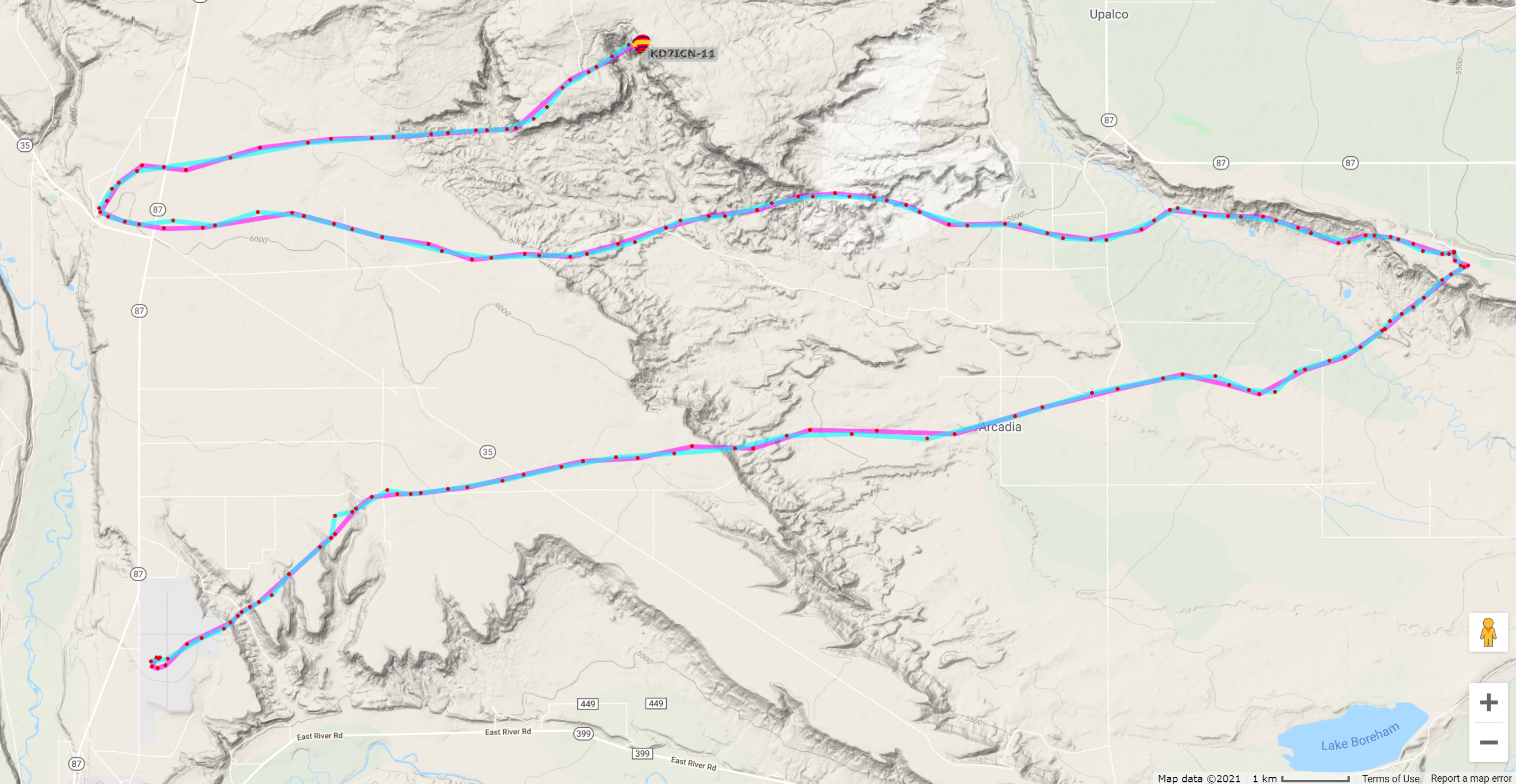
Launch Location: Duchesne Airport, U69
40.19667°N, 110.38361°W, 5820 ft ASL
Flight Manifest, Masses,
Fill, and Schedule (pdf)
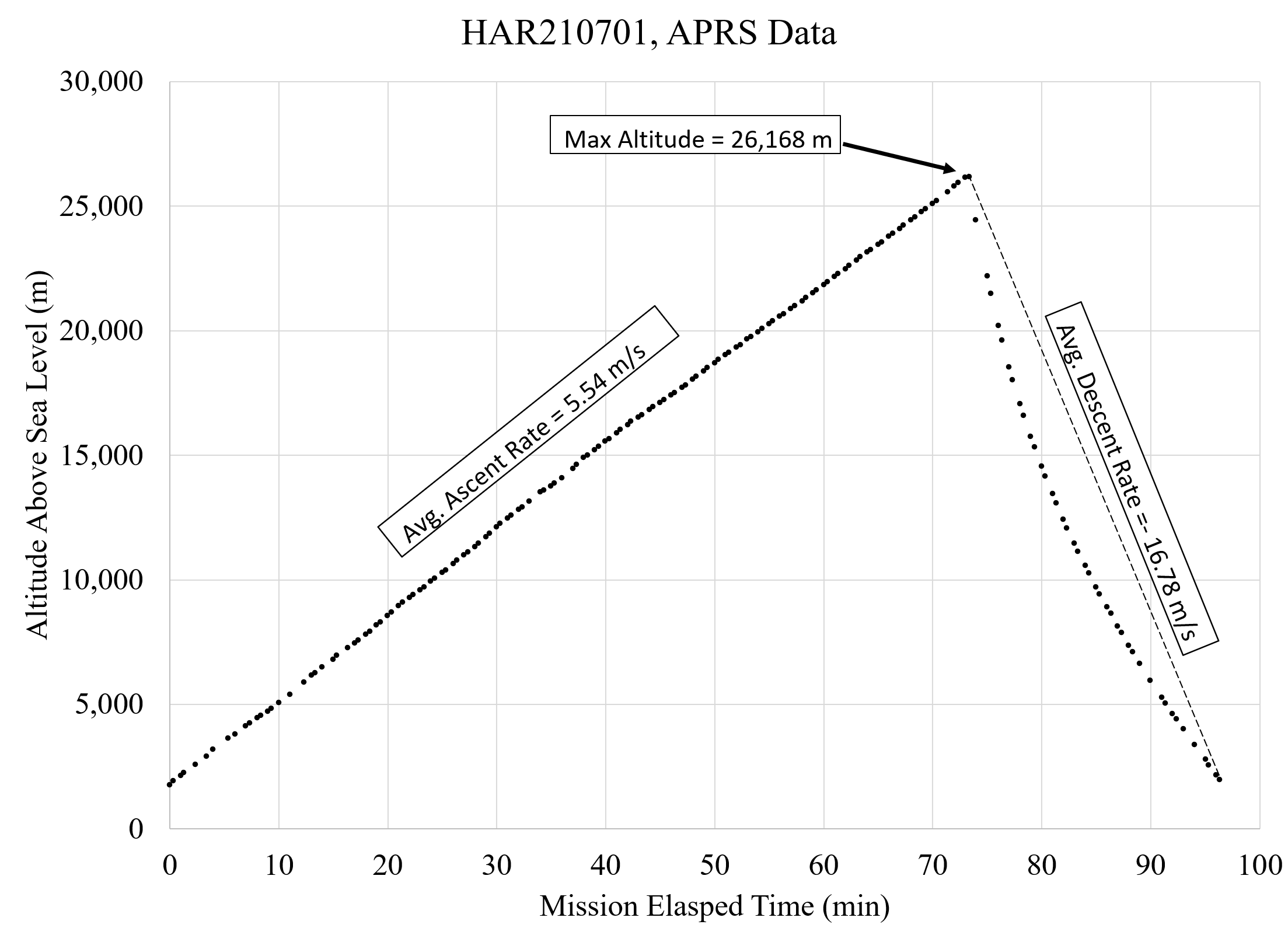
Excel Analysis of the APRS data.
Excel File for the
Flight Manifest Mass Calculations.
Misc. Notes:
- Round trip travel distance in main SUV = 344 miles
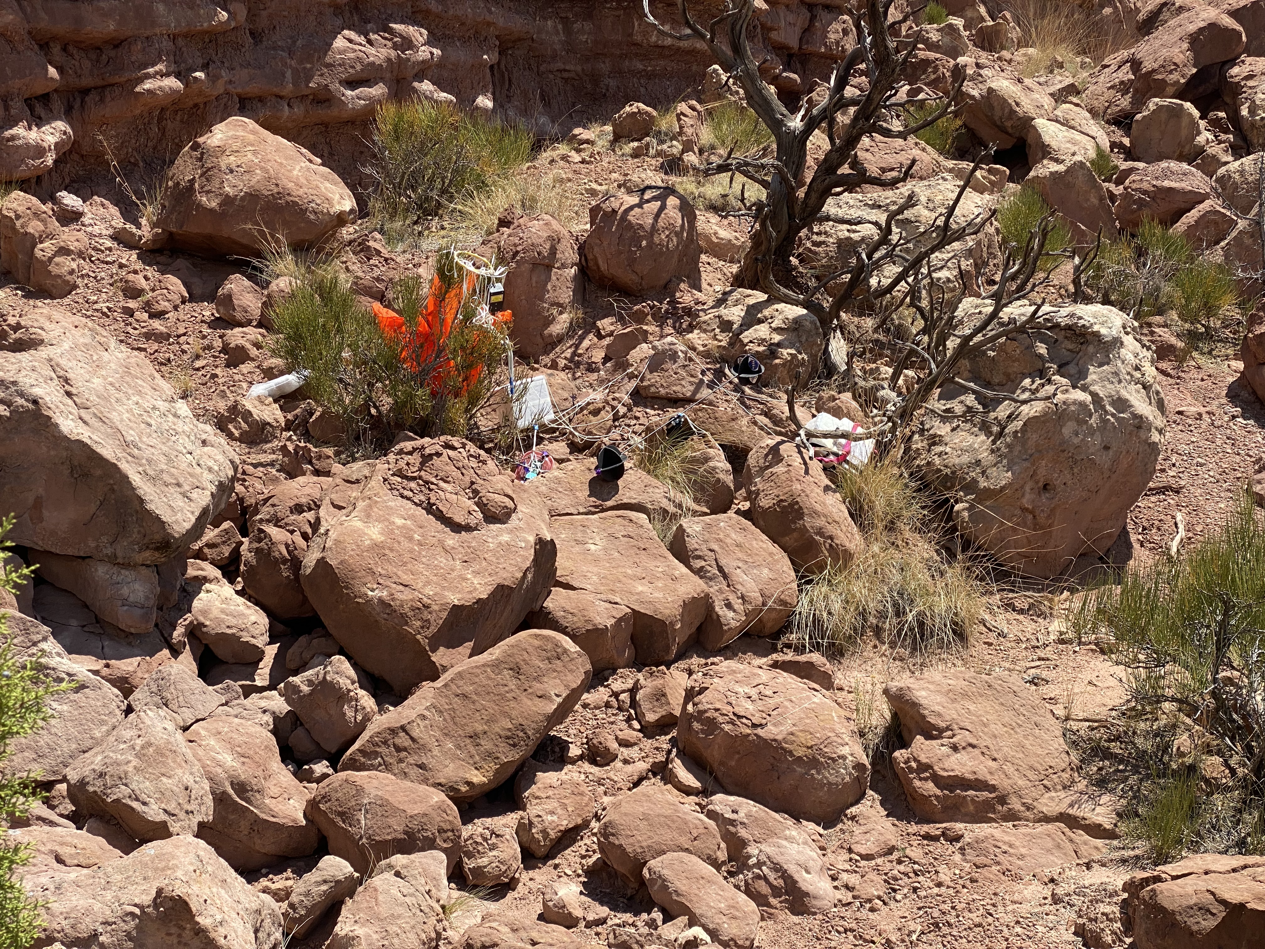
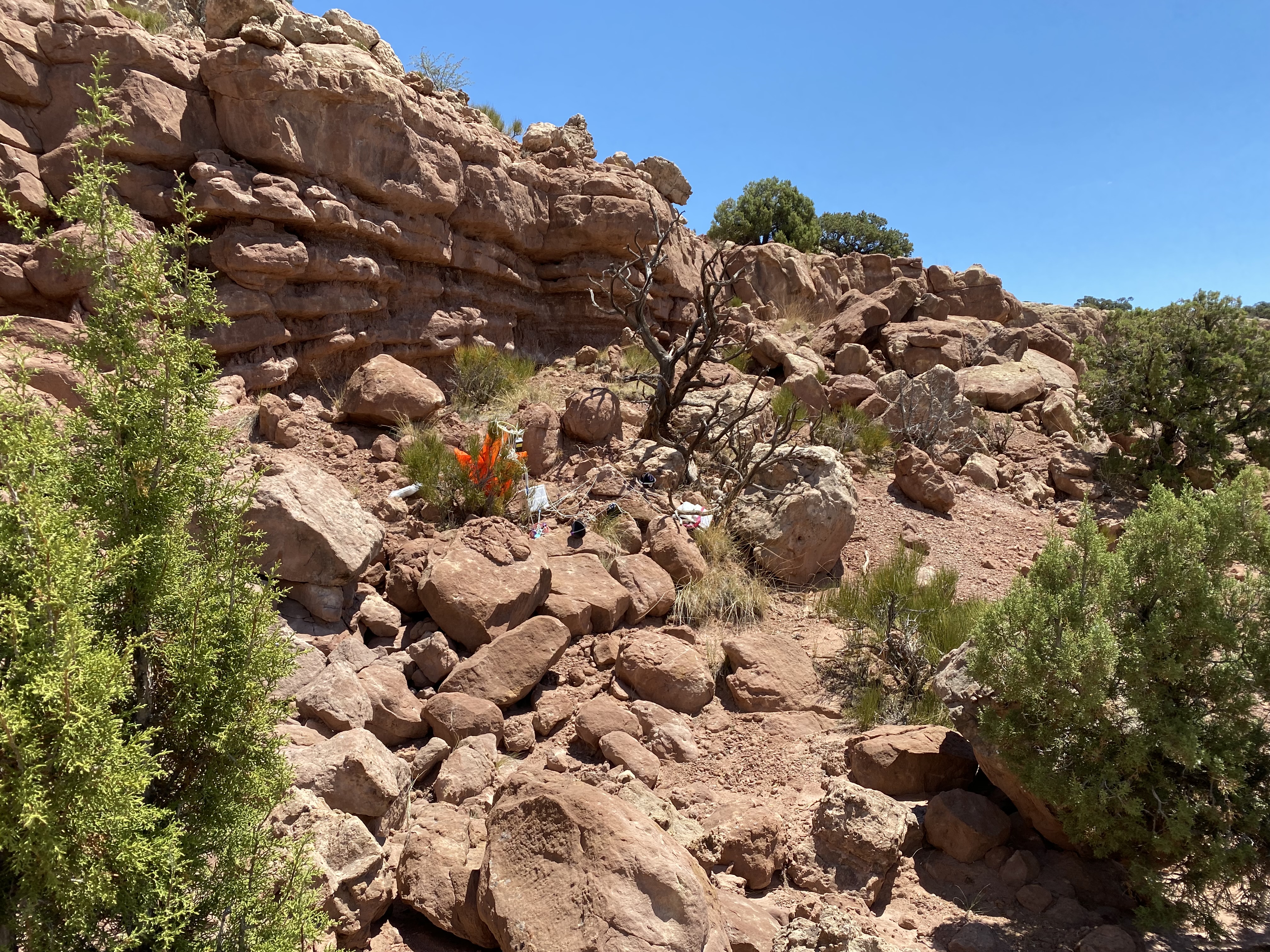
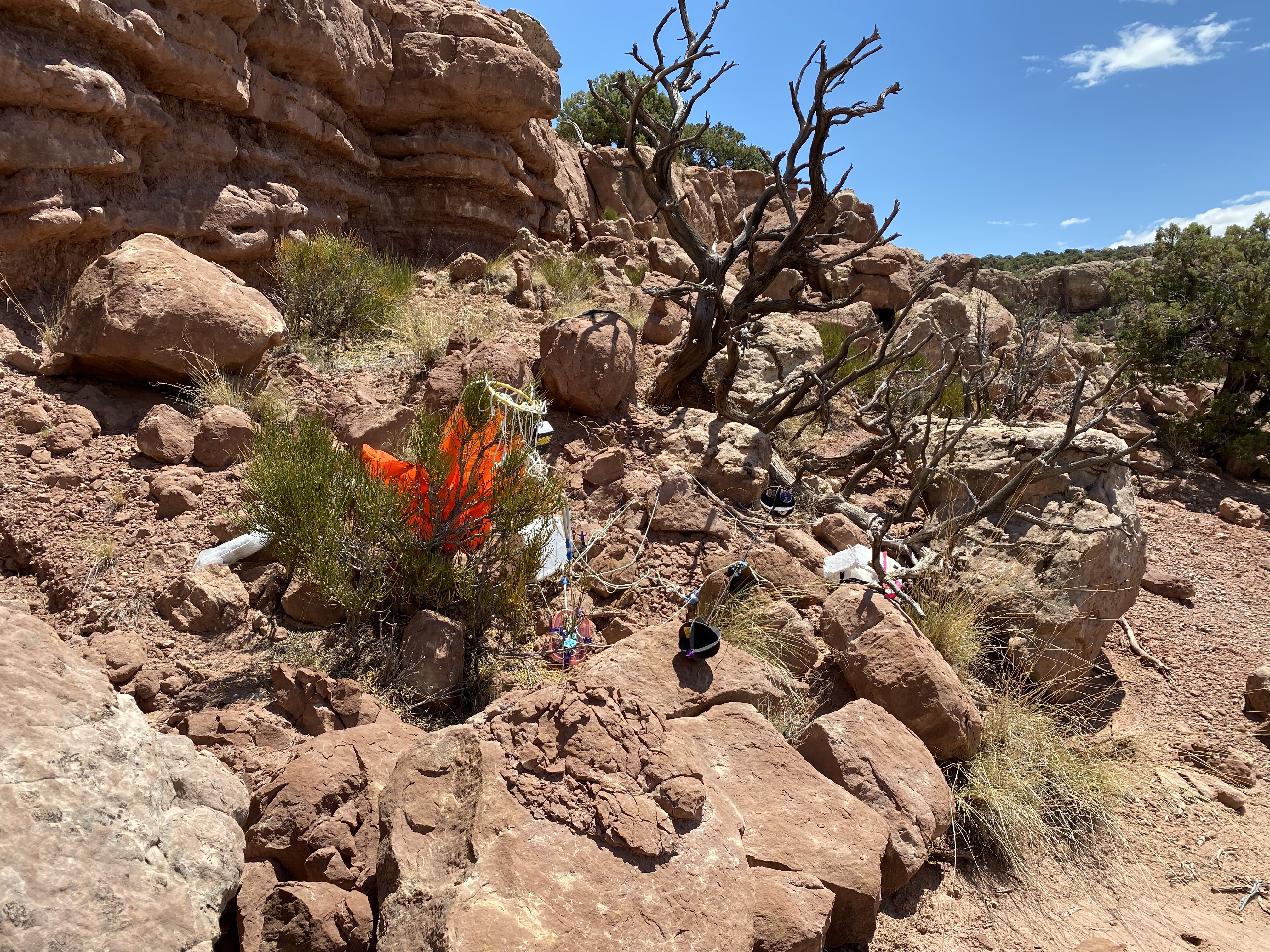
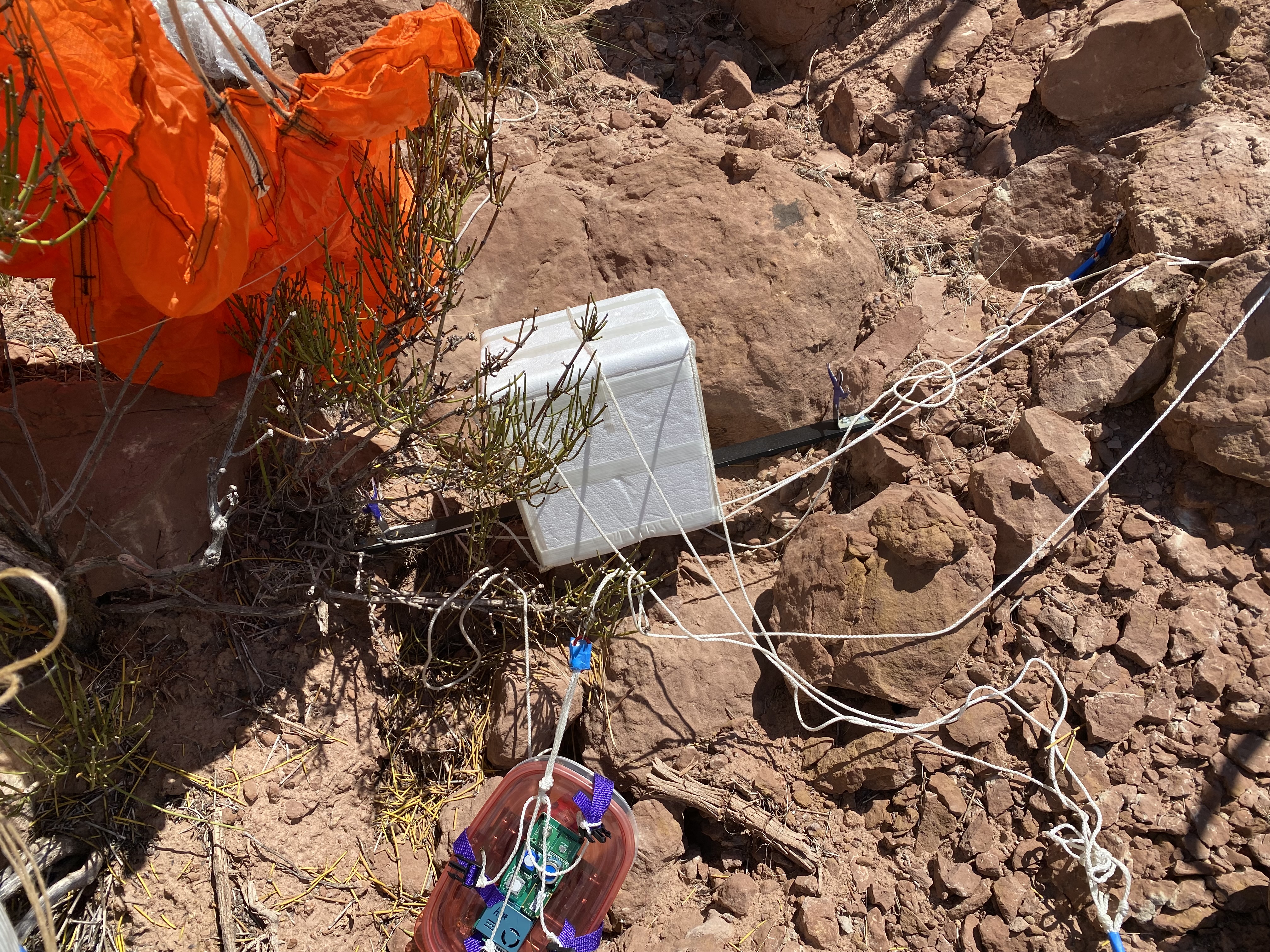
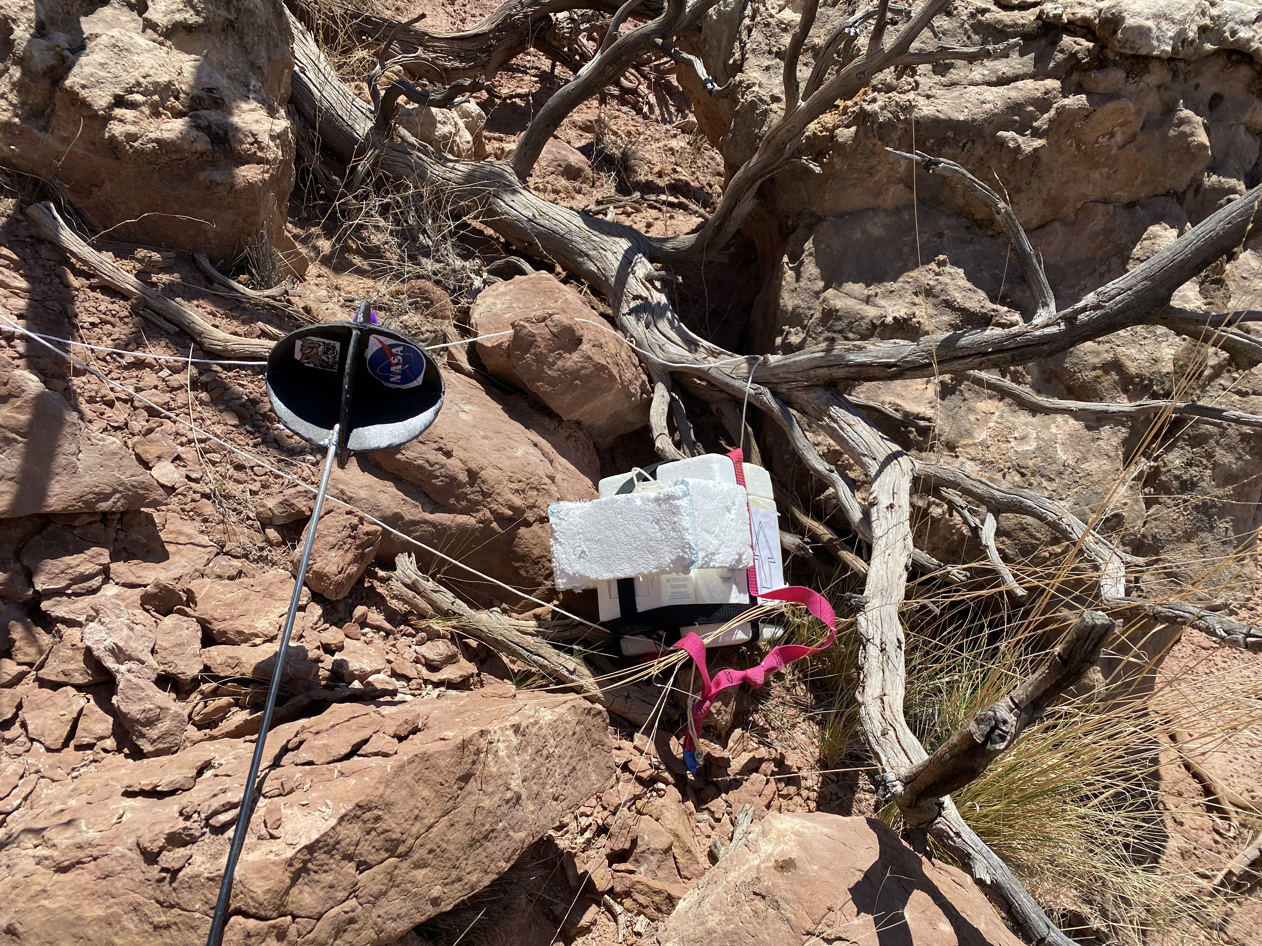
- The parachute almost certainly was fouled. The descent rate was -16.7
m/s should be closer to -7.5 m/s. The payload landed hard on a rock
outcropping.
- Ozonesonde was not tracked to the ground, but was pretty close. We need
to remember to track it the next time from the chase vehicle.
- Tracking maps are old. New maps have been downloaded for use on the next
flight.
- Checklist for packing was updated. We forgot tent stakes for the popup
shelters.
- Next flight we want to place the hardware under a popup ("easy-up")
shelter to shade it from the Sun.
- Landed in cliff bands east of Al's house. Next time we should bring
climbing equipment.
- MSA data were lost. The card was corrupted. We also lost power when one
battery was shaken out of its holder. Next time they need to be secured. We
need the improved housings. The hard landing shattered the Rubbermaid
sandwich box housing. The hardware was undamaged.
Raw data:
APRS packets KD7 and
KF7, KMZ files for Google Earth for
KD7 and
KF7
Flight Profile:
Flight Profile and Prediction:
Landing: